Arif Mohaimin Sadri
Community-based Behavioral Understanding of Crisis Activity Concerns using Social Media Data: A Study on the 2023 Canadian Wildfires in New York City
Jan 22, 2024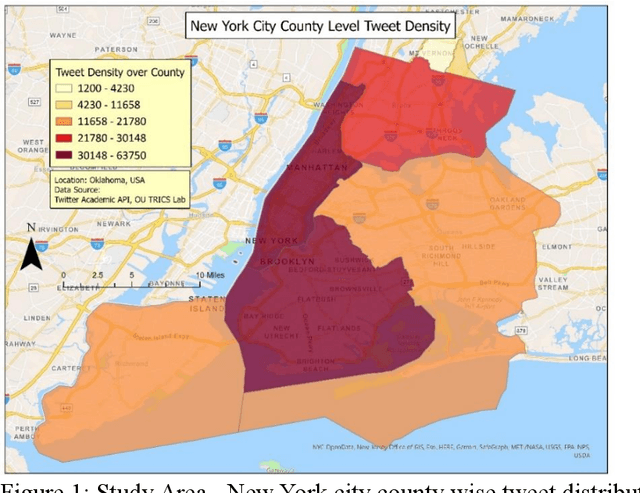
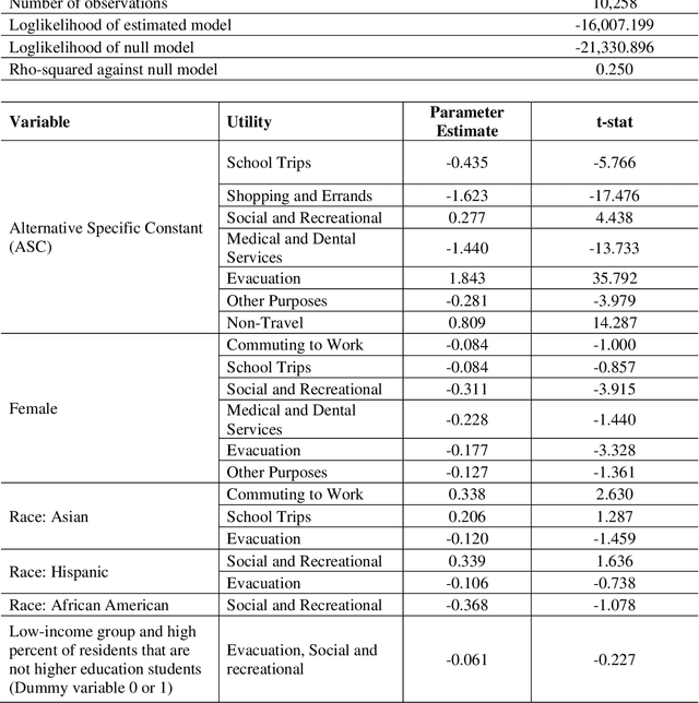
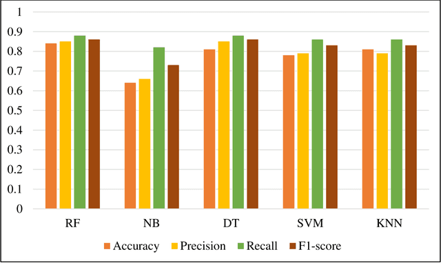
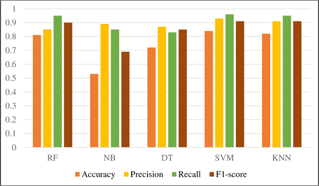
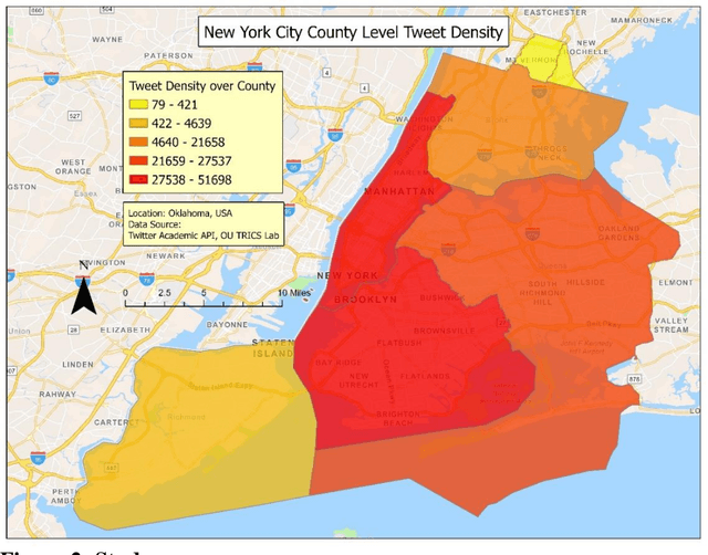
Abstract:New York City (NYC) topped the global chart for the worst air pollution in June 2023, owing to the wildfire smoke drifting in from Canada. This unprecedented situation caused significant travel disruptions and shifts in traditional activity patterns of NYC residents. This study utilized large-scale social media data to study different crisis activity concerns (i.e., evacuation, staying indoors, shopping, and recreational activities among others) in the emergence of the 2023 Canadian wildfire smoke in NYC. In this regard, one week (June 02 through June 09, 2023) geotagged Twitter data from NYC were retrieved and used in the analysis. The tweets were processed using advanced text classification techniques and later integrated with national databases such as Social Security Administration data, Census, and American Community Survey. Finally, a model has been developed to make community inferences of different activity concerns in a major wildfire. The findings suggest, during wildfires, females are less likely to engage in discussions about evacuation, trips for medical, social, or recreational purposes, and commuting for work, likely influenced by workplaces maintaining operations despite poor air quality. There were also racial disparities in these discussions, with Asians being more likely than Hispanics to discuss evacuation and work commute, and African Americans being less likely to discuss social and recreational activities. Additionally, individuals from low-income neighborhoods and non-higher education students expressed fewer concerns about evacuation. This study provides valuable insights for policymakers, emergency planners, and public health officials, aiding them in formulating targeted communication strategies and equitable emergency response plans.
Leveraging Social Media Data to Identify Factors Influencing Public Attitude Towards Accessibility, Socioeconomic Disparity and Public Transportation
Jan 22, 2024

Abstract:This study proposes a novel method to understand the factors affecting individuals' perception of transport accessibility, socioeconomic disparity, and public infrastructure. As opposed to the time consuming and expensive survey-based approach, this method can generate organic large-scale responses from social media and develop statistical models to understand individuals' perceptions of various transportation issues. This study retrieved and analyzed 36,098 tweets from New York City from March 19, 2020, to May 15, 2022. A state-of-the-art natural language processing algorithm is used for text mining and classification. A data fusion technique has been adopted to generate a series of socioeconomic traits that are used as explanatory variables in the model. The model results show that females and individuals of Asian origin tend to discuss transportation accessibility more than their counterparts, with those experiencing high neighborhood traffic also being more vocal. However, disadvantaged individuals, including the unemployed and those living in low-income neighborhoods or in areas with high natural hazard risks, tend to communicate less about such issues. As for socioeconomic disparity, individuals of Asian origin and those experiencing various types of air pollution are more likely to discuss these topics on Twitter, often with a negative sentiment. However, unemployed, or disadvantaged individuals, as well as those living in areas with high natural hazard risks or expected losses, are less inclined to tweet about this subject. Lack of internet accessibility could be a reason why many disadvantaged individuals do not tweet about transport accessibility and subsidized internet could be a possible solution.
A Data-driven Resilience Framework of Directionality Configuration based on Topological Credentials in Road Networks
Jan 14, 2024Abstract:Roadway reconfiguration is a crucial aspect of transportation planning, aiming to enhance traffic flow, reduce congestion, and improve overall road network performance with existing infrastructure and resources. This paper presents a novel roadway reconfiguration technique by integrating optimization based Brute Force search approach and decision support framework to rank various roadway configurations for better performance. The proposed framework incorporates a multi-criteria decision analysis (MCDA) approach, combining input from generated scenarios during the optimization process. By utilizing data from optimization, the model identifies total betweenness centrality (TBC), system travel time (STT), and total link traffic flow (TLTF) as the most influential decision variables. The developed framework leverages graph theory to model the transportation network topology and apply network science metrics as well as stochastic user equilibrium traffic assignment to assess the impact of each roadway configuration on the overall network performance. To rank the roadway configurations, the framework employs machine learning algorithms, such as ridge regression, to determine the optimal weights for each criterion (i.e., TBC, STT, TLTF). Moreover, the network-based analysis ensures that the selected configurations not only optimize individual roadway segments but also enhance system-level efficiency, which is particularly helpful as the increasing frequency and intensity of natural disasters and other disruptive events underscore the critical need for resilient transportation networks. By integrating multi-criteria decision analysis, machine learning, and network science metrics, the proposed framework would enable transportation planners to make informed and data-driven decisions, leading to more sustainable, efficient, and resilient roadway configurations.
 Add to Chrome
 Add to Firefox
 Add to Edge