Amilcar Soares Junior
On feature selection and evaluation of transportation mode prediction strategies
Sep 05, 2018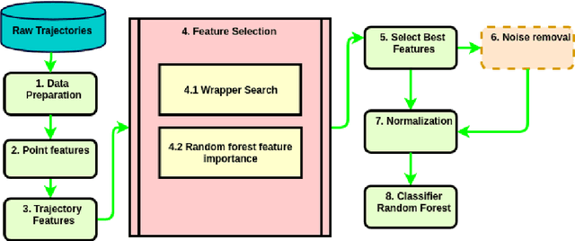
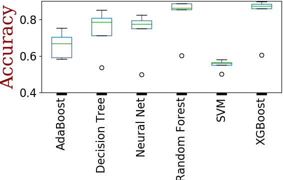
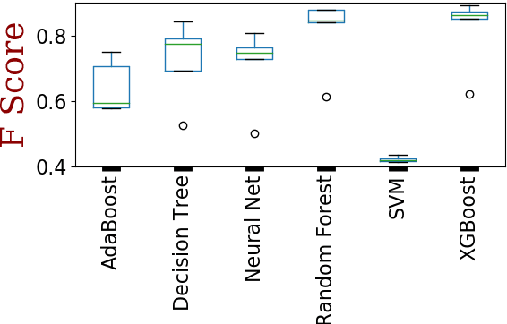
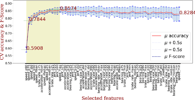
Abstract:Transportation modes prediction is a fundamental task for decision making in smart cities and traffic management systems. Traffic policies designed based on trajectory mining can save money and time for authorities and the public. It may reduce the fuel consumption and commute time and moreover, may provide more pleasant moments for residents and tourists. Since the number of features that may be used to predict a user transportation mode can be substantial, finding a subset of features that maximizes a performance measure is worth investigating. In this work, we explore wrapper and information retrieval methods to find the best subset of trajectory features. After finding the best classifier and the best feature subset, our results were compared with two related papers that applied deep learning methods and the results showed that our framework achieved better performance. Furthermore, two types of cross-validation approaches were investigated, and the performance results show that the random cross-validation method provides optimistic results.
Predicting Crime Using Spatial Features
Mar 12, 2018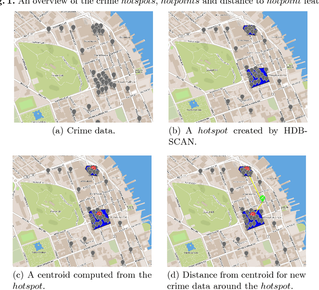

Abstract:Our study aims to build a machine learning model for crime prediction using geospatial features for different categories of crime. The reverse geocoding technique is applied to retrieve open street map (OSM) spatial data. This study also proposes finding hotpoints extracted from crime hotspots area found by Hierarchical Density-Based Spatial Clustering of Applications with Noise (HDBSCAN). A spatial distance feature is then computed based on the position of different hotpoints for various types of crime and this value is used as a feature for classifiers. We test the engineered features in crime data from Royal Canadian Mounted Police of Halifax, NS. We observed a significant performance improvement in crime prediction using the new generated spatial features.
 Add to Chrome
 Add to Firefox
 Add to Edge