Akshatha Mohan
Spatial Transformer Network YOLO Model for Agricultural Object Detection
Jul 31, 2024


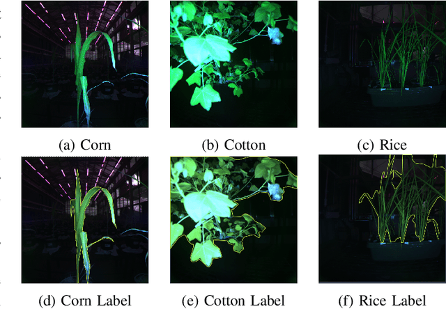
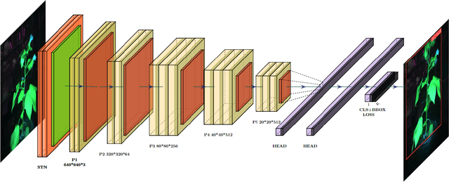
Abstract:Object detection plays a crucial role in the field of computer vision by autonomously identifying and locating objects of interest. The You Only Look Once (YOLO) model is an effective single-shot detector. However, YOLO faces challenges in cluttered or partially occluded scenes and can struggle with small, low-contrast objects. We propose a new method that integrates spatial transformer networks (STNs) into YOLO to improve performance. The proposed STN-YOLO aims to enhance the model's effectiveness by focusing on important areas of the image and improving the spatial invariance of the model before the detection process. Our proposed method improved object detection performance both qualitatively and quantitatively. We explore the impact of different localization networks within the STN module as well as the robustness of the model across different spatial transformations. We apply the STN-YOLO on benchmark datasets for Agricultural object detection as well as a new dataset from a state-of-the-art plant phenotyping greenhouse facility. Our code and dataset are publicly available.
Lacunarity Pooling Layers for Plant Image Classification using Texture Analysis
Apr 25, 2024


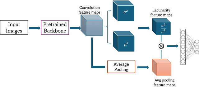
Abstract:Pooling layers (e.g., max and average) may overlook important information encoded in the spatial arrangement of pixel intensity and/or feature values. We propose a novel lacunarity pooling layer that aims to capture the spatial heterogeneity of the feature maps by evaluating the variability within local windows. The layer operates at multiple scales, allowing the network to adaptively learn hierarchical features. The lacunarity pooling layer can be seamlessly integrated into any artificial neural network architecture. Experimental results demonstrate the layer's effectiveness in capturing intricate spatial patterns, leading to improved feature extraction capabilities. The proposed approach holds promise in various domains, especially in agricultural image analysis tasks. This work contributes to the evolving landscape of artificial neural network architectures by introducing a novel pooling layer that enriches the representation of spatial features. Our code is publicly available.
Quantitative Analysis of Primary Attribution Explainable Artificial Intelligence Methods for Remote Sensing Image Classification
Jun 06, 2023Abstract:We present a comprehensive analysis of quantitatively evaluating explainable artificial intelligence (XAI) techniques for remote sensing image classification. Our approach leverages state-of-the-art machine learning approaches to perform remote sensing image classification across multiple modalities. We investigate the results of the models qualitatively through XAI methods. Additionally, we compare the XAI methods quantitatively through various categories of desired properties. Through our analysis, we offer insights and recommendations for selecting the most appropriate XAI method(s) to gain a deeper understanding of the models' decision-making processes. The code for this work is publicly available.
 Add to Chrome
 Add to Firefox
 Add to Edge