Abhinav Ganesan
Mining Points of Interest via Address Embeddings: An Unsupervised Approach
Sep 09, 2021


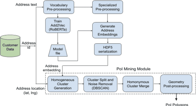
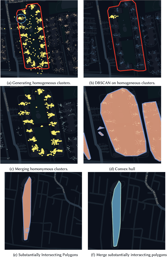
Abstract:Digital maps are commonly used across the globe for exploring places that users are interested in, commonly referred to as points of interest (PoI). In online food delivery platforms, PoIs could represent any major private compounds where customers could order from such as hospitals, residential complexes, office complexes, educational institutes and hostels. In this work, we propose an end-to-end unsupervised system design for obtaining polygon representations of PoIs (PoI polygons) from address locations and address texts. We preprocess the address texts using locality names and generate embeddings for the address texts using a deep learning-based architecture, viz. RoBERTa, trained on our internal address dataset. The PoI candidates are identified by jointly clustering the anonymised customer phone GPS locations (obtained during address onboarding) and the embeddings of the address texts. The final list of PoI polygons is obtained from these PoI candidates using novel post-processing steps. This algorithm identified 74.8 % more PoIs than those obtained using the Mummidi-Krumm baseline algorithm run on our internal dataset. The proposed algorithm achieves a median area precision of 98 %, a median area recall of 8 %, and a median F-score of 0.15. In order to improve the recall of the algorithmic polygons, we post-process them using building footprint polygons from the OpenStreetMap (OSM) database. The post-processing algorithm involves reshaping the algorithmic polygon using intersecting polygons and closed private roads from the OSM database, and accounting for intersection with public roads on the OSM database. We achieve a median area recall of 70 %, a median area precision of 69 %, and a median F-score of 0.69 on these post-processed polygons.
 Add to Chrome
 Add to Firefox
 Add to Edge