Wiometrics: Comparative Performance of Artificial Neural Networks for Wireless Navigation
Paper and Code
Sep 05, 2023


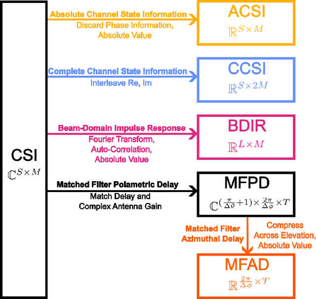
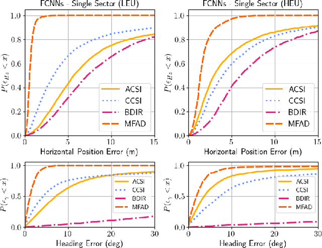
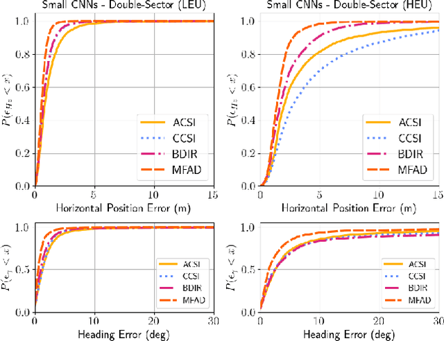
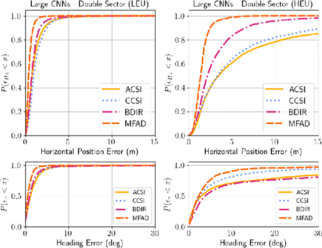
Radio signals are used broadly as navigation aids, and current and future terrestrial wireless communication systems have properties that make their dual-use for this purpose attractive. Sub-6 GHz carrier frequencies enable widespread coverage for data communication and navigation, but typically offer smaller bandwidths and limited resolution for precise estimation of geometries, particularly in environments where propagation channels are diffuse in time and/or space. Non-parametric methods have been employed with some success for such scenarios both commercially and in literature, but often with an emphasis on low-cost hardware and simple models of propagation, or with simulations that do not fully capture hardware impairments and complex propagation mechanisms. In this article, we make opportunistic observations of downlink signals transmitted by commercial cellular networks by using a software-defined radio and massive antenna array mounted on a passenger vehicle in an urban non line-of-sight scenario, together with a ground truth reference for vehicle pose. With these observations as inputs, we employ artificial neural networks to generate estimates of vehicle location and heading for various artificial neural network architectures and different representations of the input observation data, which we call wiometrics, and compare the performance for navigation. Position accuracy on the order of a few meters, and heading accuracy of a few degrees, are achieved for the best-performing combinations of networks and wiometrics. Based on the results of the experiments we draw conclusions regarding possible future directions for wireless navigation using statistical methods.
 Add to Chrome
 Add to Firefox
 Add to Edge