SXL: Spatially explicit learning of geographic processes with auxiliary tasks
Paper and Code
Jun 18, 2020


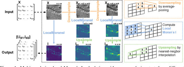
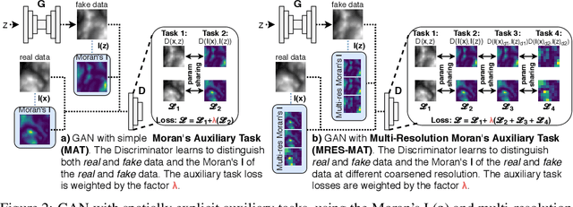
From earth system sciences to climate modeling and ecology, many of the greatest empirical modeling challenges are geographic in nature. As these processes are characterized by spatial dynamics, we can exploit their autoregressive nature to inform learning algorithms. We introduce SXL, a method for learning with geospatial data using explicitly spatial auxiliary tasks. We embed the local Moran's I, a well-established measure of local spatial autocorrelation, into the training process, "nudging" the model to learn the direction and magnitude of local autoregressive effects in parallel with the primary task. Further, we propose an expansion of Moran's I to multiple resolutions to capture effects at different spatial granularities and over varying distance scales. We show the superiority of this method for training deep neural networks using experiments with real-world geospatial data in both generative and predictive modeling tasks. Our approach can be used with arbitrary network architectures and, in our experiments, consistently improves their performance. We also outperform appropriate, domain-specific interpolation benchmarks. Our work highlights how integrating the geographic information sciences and spatial statistics into machine learning models can address the specific challenges of spatial data.
 Add to Chrome
 Add to Firefox
 Add to Edge