Surface Deformation of New York City from Multitemporal Interferometric Analysis of Sentinel-1 SAR Datasets
Paper and Code
Jul 26, 2023


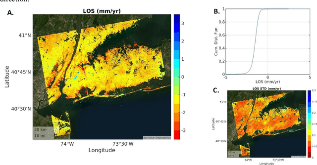
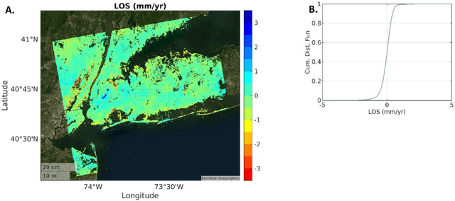
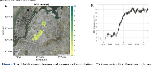
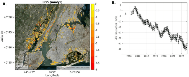
Sentinel-1, the Synthetic Aperture Radar (SAR) mission operated by the European Space Agency (ESA) as part of the Copernicus program, provides Free and Open Data with global coverage, transforming our ability to monitor subtle changes in land surface elevation due to natural and anthropogenic process. Here, we use SAR datasets over New York spanning 2015/03/12 to 2022/08/26 and apply an advanced multitemporal SAR interferometric algorithm to measure rates and time series of surface deformation at an unprecedented resolution and accuracy. We found Line-Of-Sight (LOS) subsidence and uplift rates of up to 25.7 -+ 0.2 mm/yr and 8.7 -+ 0.3 mm/yr affecting parts of the city. The LOS velocities, standard deviations, and local incidence angles for ~1,792,000 pixels at ~25m -+ 25 m resolution are provided in an online repository.
 Add to Chrome
 Add to Firefox
 Add to Edge