 Add to Chrome
 Add to Firefox
 Add to Edge
SmartScan: An AI-based Interactive Framework for Automated Region Extraction from Satellite Images
Paper and Code
Mar 31, 2025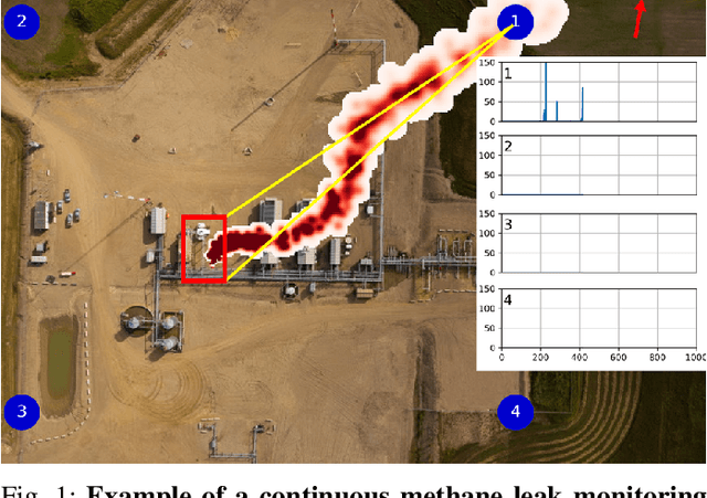
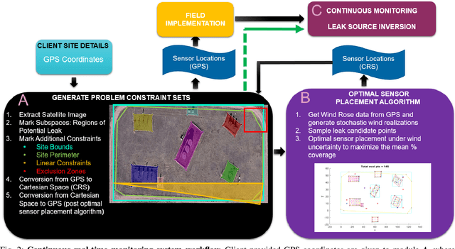
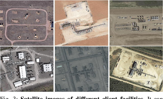
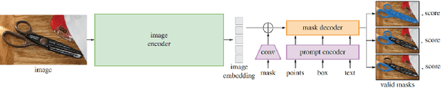
The deployment of a continuous methane monitoring system requires determining the optimal number and placement of fixed sensors. However, planning is labor-intensive, requiring extensive site setup and iteration to meet client restrictions. This challenge is amplified when evaluating multiple sites, limiting scalability. To address this, we introduce SmartScan, an AI framework that automates data extraction for optimal sensor placement. SmartScan identifies subspaces of interest from satellite images using an interactive tool to create facility-specific constraint sets efficiently. SmartScan leverages the Segment Anything Model (SAM), a prompt-based transformer for zero-shot segmentation, enabling subspace extraction without explicit training. It operates in two modes: (1) Data Curation Mode, where satellite images are processed to extract high-quality subspaces using an interactive prompting system for SAM, and (2) Autonomous Mode, where user-curated prompts train a deep learning network to replace manual prompting, fully automating subspace extraction. The interactive tool also serves for quality control, allowing users to refine AI-generated outputs and generate additional constraint sets as needed. With its AI-driven prompting mechanism, SmartScan delivers high-throughput, high-quality subspace extraction with minimal human intervention, enhancing scalability and efficiency. Notably, its adaptable design makes it suitable for extracting regions of interest from ultra-high-resolution satellite imagery across various domains.