SATIN: A Multi-Task Metadataset for Classifying Satellite Imagery using Vision-Language Models
Paper and Code
Apr 23, 2023


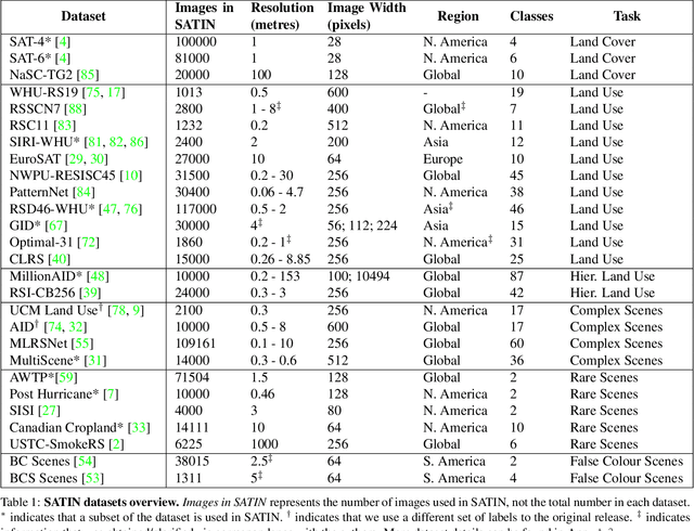
Interpreting remote sensing imagery enables numerous downstream applications ranging from land-use planning to deforestation monitoring. Robustly classifying this data is challenging due to the Earth's geographic diversity. While many distinct satellite and aerial image classification datasets exist, there is yet to be a benchmark curated that suitably covers this diversity. In this work, we introduce SATellite ImageNet (SATIN), a metadataset curated from 27 existing remotely sensed datasets, and comprehensively evaluate the zero-shot transfer classification capabilities of a broad range of vision-language (VL) models on SATIN. We find SATIN to be a challenging benchmark-the strongest method we evaluate achieves a classification accuracy of 52.0%. We provide a $\href{https://satinbenchmark.github.io}{\text{public leaderboard}}$ to guide and track the progress of VL models in this important domain.
 Add to Chrome
 Add to Firefox
 Add to Edge