 Add to Chrome
 Add to Firefox
 Add to Edge
Probabilistic graphical model based approach for water mapping using GaoFen-2 (GF-2) high resolution imagery and Landsat 8 time series
Paper and Code
Dec 22, 2016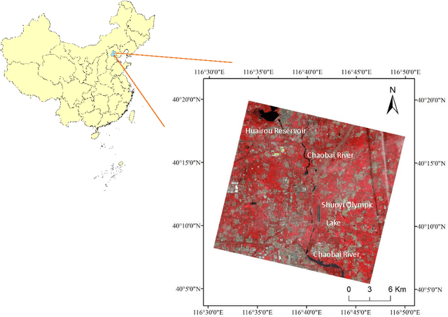
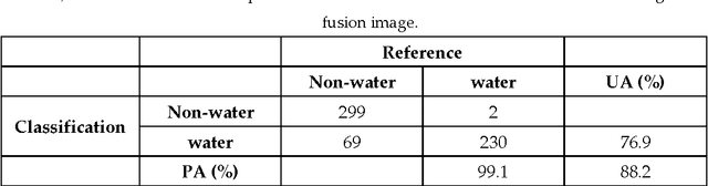
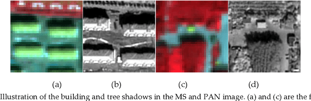
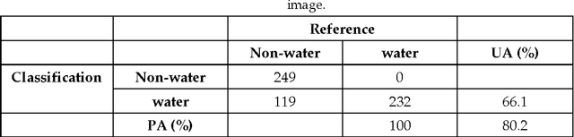
The objective of this paper is to evaluate the potential of Gaofen-2 (GF-2) high resolution multispectral sensor (MS) and panchromatic (PAN) imagery on water mapping. Difficulties of water mapping on high resolution data includes: 1) misclassification between water and shadows or other low-reflectance ground objects, which is mostly caused by the spectral similarity within the given band range; 2) small water bodies with size smaller than the spatial resolution of MS image. To solve the confusion between water and low-reflectance objects, the Landsat 8 time series with two shortwave infrared (SWIR) bands is added because water has extremely strong absorption in SWIR. In order to integrate the three multi-sensor, multi-resolution data sets, the probabilistic graphical model (PGM) is utilized here with conditional probability distribution defined mainly based on the size of each object. For comparison, results from the SVM classifier on the PCA fused and MS data, thresholding method on the PAN image, and water index method on the Landsat data are computed. The confusion matrices are calculated for all the methods. The results demonstrate that the PGM method can achieve the best performance with the highest overall accuracy. Moreover, small rivers can also be extracted by adding weight on the PAN result in PGM. Finally, the post-classification procedure is applied on the PGM result to further exclude misclassification in shadow and water-land boundary regions. Accordingly, the producer's, user's and overall accuracy are all increased, indicating the effectiveness of our method.