 Add to Chrome
 Add to Firefox
 Add to Edge
Mapping industrial poultry operations at scale with deep learning and aerial imagery
Paper and Code
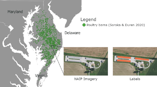

Concentrated Animal Feeding Operations (CAFOs) pose serious risks to air, water, and public health, but have proven to be challenging to regulate. The U.S. Government Accountability Office notes that a basic challenge is the lack of comprehensive location information on CAFOs. We use the USDA's National Agricultural Imagery Program (NAIP) 1m/pixel aerial imagery to detect poultry CAFOs across the continental United States. We train convolutional neural network (CNN) models to identify individual poultry barns and apply the best performing model to over 42 TB of imagery to create the first national, open-source dataset of poultry CAFOs. We validate the model predictions against held-out validation set on poultry CAFO facility locations from 10 hand-labeled counties in California and demonstrate that this approach has significant potential to fill gaps in environmental monitoring.