Localizing and Quantifying Damage in Social Media Images
Paper and Code
Jun 09, 2018


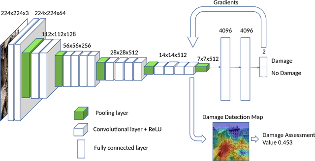
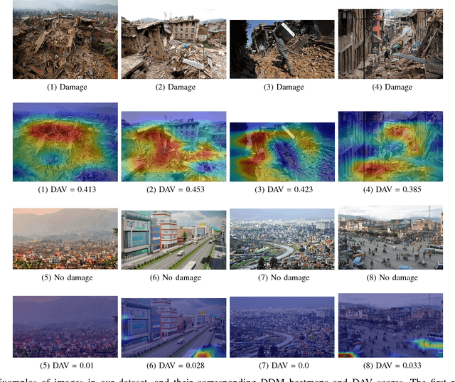
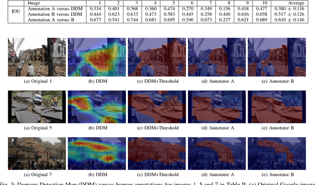
Traditional post-disaster assessment of damage heavily relies on expensive GIS data, especially remote sensing image data. In recent years, social media has become a rich source of disaster information that may be useful in assessing damage at a lower cost. Such information includes text (e.g., tweets) or images posted by eyewitnesses of a disaster. Most of the existing research explores the use of text in identifying situational awareness information useful for disaster response teams. The use of social media images to assess disaster damage is limited. In this paper, we propose a novel approach, based on convolutional neural networks and class activation maps, to locate damage in a disaster image and to quantify the degree of the damage. Our proposed approach enables the use of social network images for post-disaster damage assessment and provides an inexpensive and feasible alternative to the more expensive GIS approach.
 Add to Chrome
 Add to Firefox
 Add to Edge