Forecasting Tropical Cyclones with Cascaded Diffusion Models
Paper and Code
Oct 04, 2023


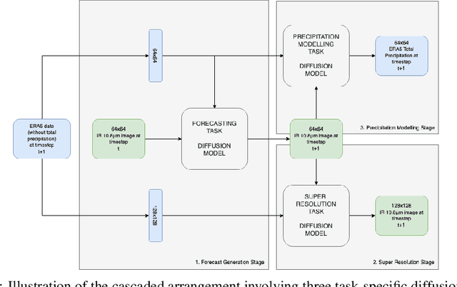
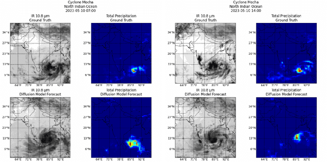
As cyclones become more intense due to climate change, the rise of AI-based modelling provides a more affordable and accessible approach compared to traditional methods based on mathematical models. This work leverages diffusion models to forecast cyclone trajectories and precipitation patterns by integrating satellite imaging, remote sensing, and atmospheric data, employing a cascaded approach that incorporates forecasting, super-resolution, and precipitation modelling, with training on a dataset of 51 cyclones from six major basins. Experiments demonstrate that the final forecasts from the cascaded models show accurate predictions up to a 36-hour rollout, with SSIM and PSNR values exceeding 0.5 and 20 dB, respectively, for all three tasks. This work also highlights the promising efficiency of AI methods such as diffusion models for high-performance needs, such as cyclone forecasting, while remaining computationally affordable, making them ideal for highly vulnerable regions with critical forecasting needs and financial limitations. Code accessible at \url{https://github.com/nathzi1505/forecast-diffmodels}.
 Add to Chrome
 Add to Firefox
 Add to Edge