Filling Missing Values Matters for Range Image-Based Point Cloud Segmentation
Paper and Code
May 16, 2024


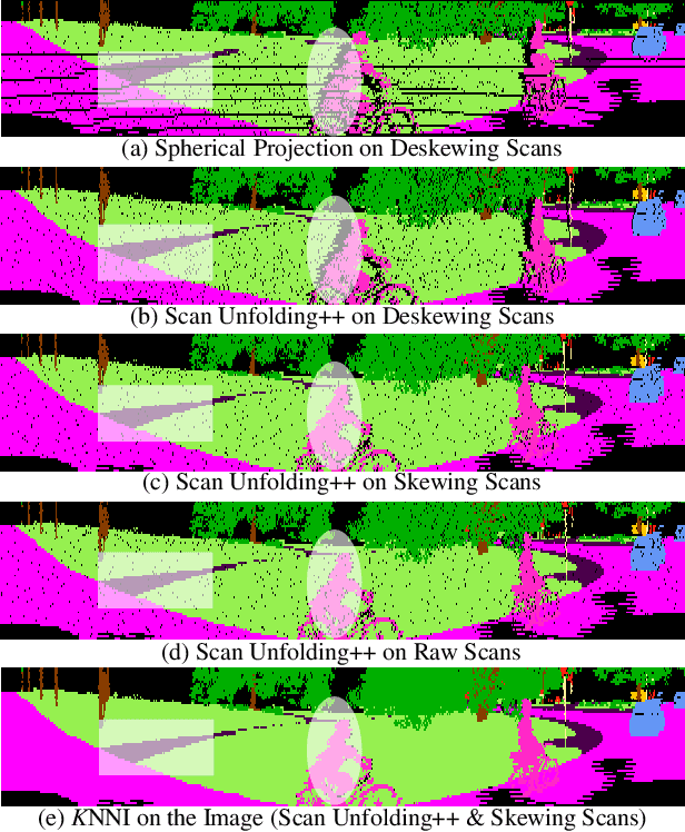
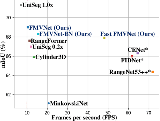
Point cloud segmentation (PCS) plays an essential role in robot perception and navigation tasks. To efficiently understand large-scale outdoor point clouds, their range image representation is commonly adopted. This image-like representation is compact and structured, making range image-based PCS models practical. However, undesirable missing values in the range images damage the shapes and patterns of objects. This problem creates difficulty for the models in learning coherent and complete geometric information from the objects. Consequently, the PCS models only achieve inferior performance. Delving deeply into this issue, we find that the use of unreasonable projection approaches and deskewing scans mainly leads to unwanted missing values in the range images. Besides, almost all previous works fail to consider filling in the unexpected missing values in the PCS task. To alleviate this problem, we first propose a new projection method, namely scan unfolding++ (SU++), to avoid massive missing values in the generated range images. Then, we introduce a simple yet effective approach, namely range-dependent $K$-nearest neighbor interpolation ($K$NNI), to further fill in missing values. Finally, we introduce the Filling Missing Values Network (FMVNet) and Fast FMVNet. Extensive experimental results on SemanticKITTI, SemanticPOSS, and nuScenes datasets demonstrate that by employing the proposed SU++ and $K$NNI, existing range image-based PCS models consistently achieve better performance than the baseline models. Besides, both FMVNet and Fast FMVNet achieve state-of-the-art performance in terms of the speed-accuracy trade-off. The proposed methods can be applied to other range image-based tasks and practical applications.
 Add to Chrome
 Add to Firefox
 Add to Edge