 Add to Chrome
 Add to Firefox
 Add to Edge
Estimates of maize plant density from UAV RGB images using Faster-RCNN detection model: impact of the spatial resolution
Paper and Code
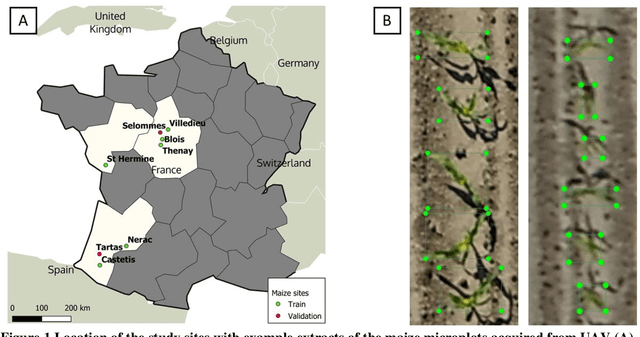
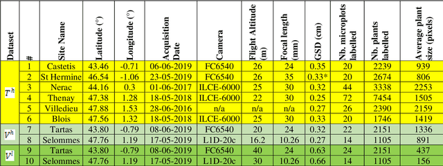
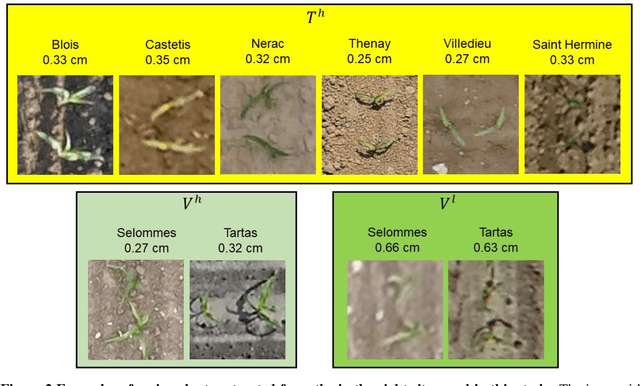
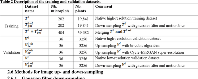
Early-stage plant density is an essential trait that determines the fate of a genotype under given environmental conditions and management practices. The use of RGB images taken from UAVs may replace traditional visual counting in fields with improved throughput, accuracy and access to plant localization. However, high-resolution (HR) images are required to detect small plants present at early stages. This study explores the impact of image ground sampling distance (GSD) on the performances of maize plant detection at 3-5 leaves stage using Faster-RCNN. Data collected at HR (GSD=0.3cm) over 6 contrasted sites were used for model training. Two additional sites with images acquired both at high and low (GSD=0.6cm) resolution were used for model evaluation. Results show that Faster-RCNN achieved very good plant detection and counting (rRMSE=0.08) performances when native HR images are used both for training and validation. Similarly, good performances were observed (rRMSE=0.11) when the model is trained over synthetic low-resolution (LR) images obtained by down-sampling the native training HR images, and applied to the synthetic LR validation images. Conversely, poor performances are obtained when the model is trained on a given spatial resolution and applied to another spatial resolution. Training on a mix of HR and LR images allows to get very good performances on the native HR (rRMSE=0.06) and synthetic LR (rRMSE=0.10) images. However, very low performances are still observed over the native LR images (rRMSE=0.48), mainly due to the poor quality of the native LR images. Finally, an advanced super-resolution method based on GAN (generative adversarial network) that introduces additional textural information derived from the native HR images was applied to the native LR validation images. Results show some significant improvement (rRMSE=0.22) compared to bicubic up-sampling approach.