Deep Learning tools to support deforestation monitoring in the Ivory Coast using SAR and Optical satellite imagery
Paper and Code
Sep 16, 2024


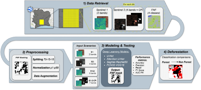
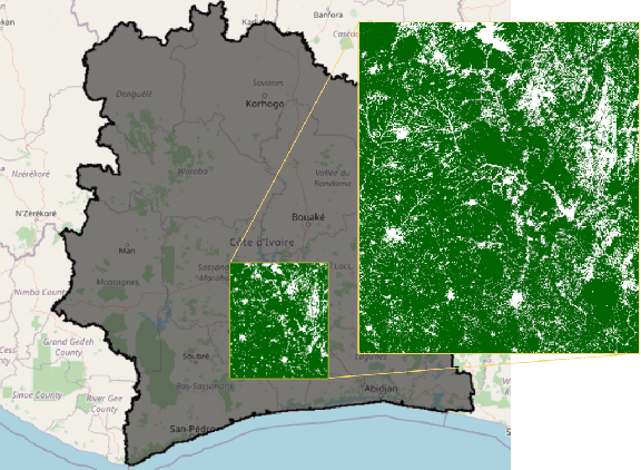
Deforestation is gaining an increasingly importance due to its strong influence on the sorrounding environment, especially in developing countries where population has a disadvantaged economic condition and agriculture is the main source of income. In Ivory Coast, for instance, where the cocoa production is the most remunerative activity, it is not rare to assist to the replacement of portion of ancient forests with new cocoa plantations. In order to monitor this type of deleterious activities, satellites can be employed to recognize the disappearance of the forest to prevent it from expand its area of interest. In this study, Forest-Non-Forest map (FNF) has been used as ground truth for models based on Sentinel images input. State-of-the-art models U-Net, Attention U-Net, Segnet and FCN32 are compared over different years combining Sentinel-1, Sentinel-2 and cloud probability to create forest/non-forest segmentation. Although Ivory Coast lacks of forest coverage datasets and is partially covered by Sentinel images, it is demonstrated the feasibility to create models classifying forest and non-forests pixels over the area using open datasets to predict where deforestation could have occurred. Although a significant portion of the deforestation research is carried out on visible bands, SAR acquisitions are employed to overcome the limits of RGB images over areas often covered by clouds. Finally, the most promising model is employed to estimate the hectares of forest has been cut between 2019 and 2020.
 Add to Chrome
 Add to Firefox
 Add to Edge