Deep Learning for automated multi-scale functional field boundaries extraction using multi-date Sentinel-2 and PlanetScope imagery: Case Study of Netherlands and Pakistan
Paper and Code
Nov 24, 2024


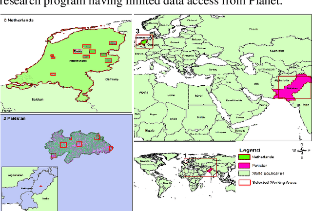
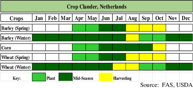
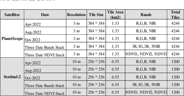
This study explores the effectiveness of multi-temporal satellite imagery for better functional field boundary delineation using deep learning semantic segmentation architecture on two distinct geographical and multi-scale farming systems of Netherlands and Pakistan. Multidate images of April, August and October 2022 were acquired for PlanetScope and Sentinel-2 in sub regions of Netherlands and November 2022, February and March 2023 for selected area of Dunyapur in Pakistan. For Netherlands, Basic registration crop parcels (BRP) vector layer was used as labeled training data. while self-crafted field boundary vector data were utilized for Pakistan. Four deep learning models with UNET architecture were evaluated using different combinations of multi-date images and NDVI stacks in the Netherlands subregions. A comparative analysis of IoU scores assessed the effectiveness of the proposed multi-date NDVI stack approach. These findings were then applied for transfer learning, using pre-trained models from the Netherlands on the selected area in Pakistan. Additionally, separate models were trained using self-crafted field boundary data for Pakistan, and combined models were developed using data from both the Netherlands and Pakistan. Results indicate that multi-date NDVI stacks provide additional temporal context, reflecting crop growth over different times of the season. The study underscores the critical role of multi-scale ground information from diverse geographical areas in developing robust and universally applicable models for field boundary delineation. The results also highlight the importance of fine spatial resolution for extraction of field boundaries in regions with small scale framing. The findings can be extended to multi-scale implementations for improved automatic field boundary delineation in heterogeneous agricultural environments.
 Add to Chrome
 Add to Firefox
 Add to Edge