Amplitude Scintillation Forecasting Using Bagged Trees
Paper and Code
Jul 18, 2022


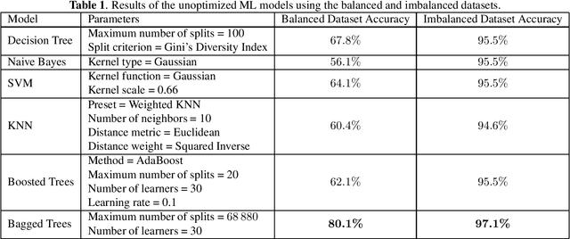
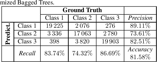
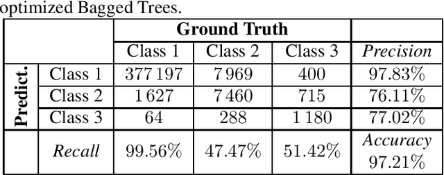
Electron density irregularities present within the ionosphere induce significant fluctuations in global navigation satellite system (GNSS) signals. Fluctuations in signal power are referred to as amplitude scintillation and can be monitored through the S4 index. Forecasting the severity of amplitude scintillation based on historical S4 index data is beneficial when real-time data is unavailable. In this work, we study the possibility of using historical data from a single GPS scintillation monitoring receiver to train a machine learning (ML) model to forecast the severity of amplitude scintillation, either weak, moderate, or severe, with respect to temporal and spatial parameters. Six different ML models were evaluated and the bagged trees model was the most accurate among them, achieving a forecasting accuracy of $81\%$ using a balanced dataset, and $97\%$ using an imbalanced dataset.
 Add to Chrome
 Add to Firefox
 Add to Edge