A multiscale spatiotemporal approach for smallholder irrigation detection
Paper and Code
Feb 09, 2022


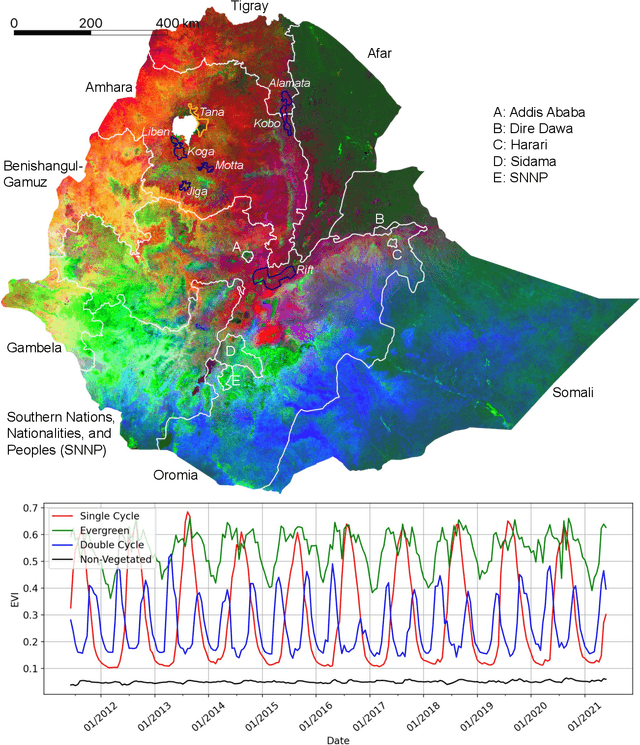
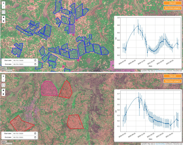
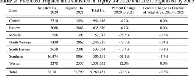
In presenting an irrigation detection methodology that leverages multiscale satellite imagery of vegetation abundance, this paper introduces a process to supplement limited ground-collected labels and ensure classifier applicability in an area of interest. Spatiotemporal analysis of MODIS 250m Enhanced Vegetation Index (EVI) timeseries characterizes native vegetation phenologies at regional scale to provide the basis for a continuous phenology map that guides supplementary label collection over irrigated and non-irrigated agriculture. Subsequently, validated dry season greening and senescence cycles observed in 10m Sentinel-2 imagery are used to train a suite of classifiers for automated detection of potential smallholder irrigation. Strategies to improve model robustness are demonstrated, including a method of data augmentation that randomly shifts training samples; and an assessment of classifier types that produce the best performance in withheld target regions. The methodology is applied to detect smallholder irrigation in two states in the Ethiopian highlands, Tigray and Amhara. Results show that a transformer-based neural network architecture allows for the most robust prediction performance in withheld regions, followed closely by a CatBoost random forest model. Over withheld ground-collection survey labels, the transformer-based model achieves 96.7% accuracy over non-irrigated samples and 95.9% accuracy over irrigated samples. Over a larger set of samples independently collected via the introduced method of label supplementation, non-irrigated and irrigated labels are predicted with 98.3% and 95.5% accuracy, respectively. The detection model is then deployed over Tigray and Amhara, revealing crop rotation patterns and year-over-year irrigated area change. Predictions suggest that irrigated area in these two states has decreased by approximately 40% from 2020 to 2021.
 Add to Chrome
 Add to Firefox
 Add to Edge