A Geospatial Approach to Predicting Desert Locust Breeding Grounds in Africa
Paper and Code
Mar 21, 2024


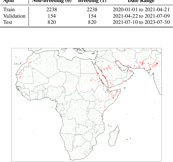
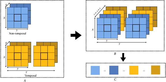
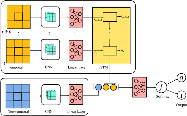
Desert locust swarms present a major threat to agriculture and food security. Addressing this challenge, our study develops an operationally-ready model for predicting locust breeding grounds, which has the potential to enhance early warning systems and targeted control measures. We curated a dataset from the United Nations Food and Agriculture Organization's (UN-FAO) locust observation records and analyzed it using two types of spatio-temporal input features: remotely-sensed environmental and climate data as well as multi-spectral earth observation images. Our approach employed custom deep learning models (three-dimensional and LSTM-based recurrent convolutional networks), along with the geospatial foundational model Prithvi recently released by Jakubik et al., 2023. These models notably outperformed existing baselines, with the Prithvi-based model, fine-tuned on multi-spectral images from NASA's Harmonized Landsat and Sentinel-2 (HLS) dataset, achieving the highest accuracy, F1 and ROC-AUC scores (83.03%, 81.53% and 87.69%, respectively). A significant finding from our research is that multi-spectral earth observation images alone are sufficient for effective locust breeding ground prediction without the need to explicitly incorporate climatic or environmental features.
 Add to Chrome
 Add to Firefox
 Add to Edge