Masazumi Amakata
Water Surface Patch Classification Using Mixture Augmentation for River Scum Index
Jul 13, 2022
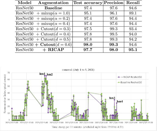
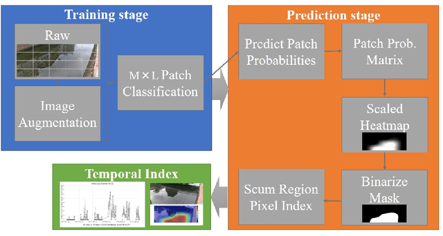
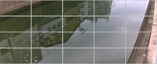
Abstract:Urban rivers provide a water environment that influences residential living. River surface monitoring has become crucial for making decisions about where to prioritize cleaning and when to automatically start the cleaning treatment. We focus on the organic mud, or "scum" that accumulates on the river's surface and gives it its peculiar odor and external economic effects on the landscape. Because of its feature of a sparsely distributed and unstable pattern of organic shape, automating the monitoring has proved difficult. We propose a patch classification pipeline to detect scum features on the river surface using mixture image augmentation to increase the diversity between the scum floating on the river and the entangled background on the river surface reflected by nearby structures like buildings, bridges, poles, and barriers. Furthermore, we propose a scum index covered on rivers to help monitor worse grade online, collecting floating scum and deciding on chemical treatment policies. Finally, we show how to use our method on a time series dataset with frames every ten minutes recording river scum events over several days. We discuss the value of our pipeline and its experimental findings.
L2-norm Ensemble Regression with Ocean Feature Weights by Analyzed Images for Flood Inflow Forecast
Dec 06, 2021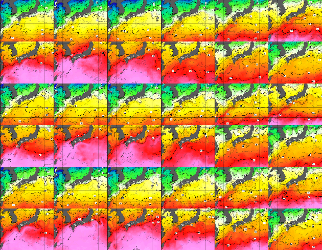

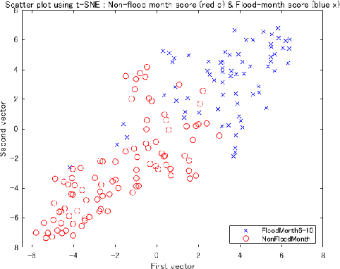
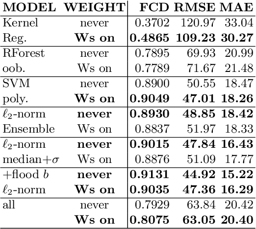
Abstract:It is important to forecast dam inflow for flood damage mitigation. The hydrograph provides critical information such as the start time, peak level, and volume. Particularly, dam management requires a 6-h lead time of the dam inflow forecast based on a future hydrograph. The authors propose novel target inflow weights to create an ocean feature vector extracted from the analyzed images of the sea surface. We extracted 4,096 elements of the dimension vector in the fc6 layer of the pre-trained VGG16 network. Subsequently, we reduced it to three dimensions of t-SNE. Furthermore, we created the principal component of the sea temperature weights using PCA. We found that these weights contribute to the stability of predictor importance by numerical experiments. As base regression models, we calibrate the least squares with kernel expansion, the quantile random forest minimized out-of bag error, and the support vector regression with a polynomial kernel. When we compute the predictor importance, we visualize the stability of each variable importance introduced by our proposed weights, compared with other results without weights. We apply our method to a dam at Kanto region in Japan and focus on the trained term from 2007 to 2018, with a limited flood term from June to October. We test the accuracy over the 2019 flood term. Finally, we present the applied results and further statistical learning for unknown flood forecast.
Generative Damage Learning for Concrete Aging Detection using Auto-flight Images
Jun 27, 2020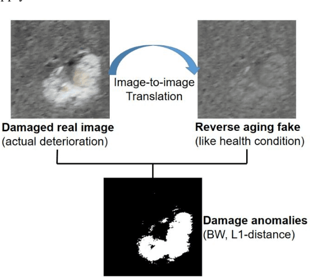

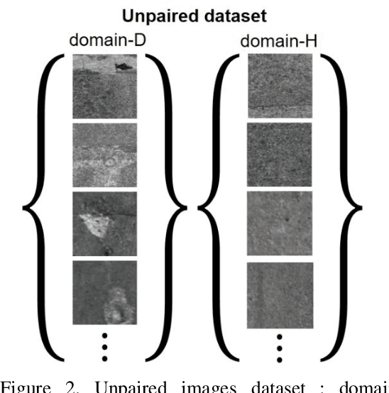
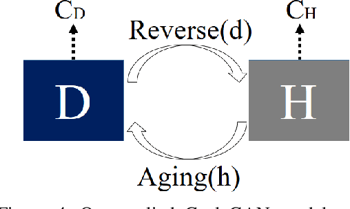
Abstract:In order to health monitoring the state of large scale infrastructures, image acquisition by autonomous flight drone is efficient for stable angle and high quality image. Supervised learning requires a great deal of data set consisting images and annotation labels. It takes long time to accumulate images including damaged region of interest (ROI). In recent years, unsupervised deep learning approach such as generative adversarial network (GAN) for anomaly detection algorithms have progressed. When a damaged image is a generator input, it tends to reverse from the damaged state to the health-like state image. Using the distance of distribution between the real damaged image and the generated reverse aging health-like image, it is possible to detect the concrete damage automatically from unsupervised learning. This paper proposes an anomaly detection method using unpaired image-to-image translation mapping from damaged image to reverse aging fake like health condition. Actually, we apply our method to field studies, and we examine the usefulness for health monitoring concrete damages.
 Add to Chrome
 Add to Firefox
 Add to Edge