Aswathi Mundayatt
Evolution of Data-driven Single- and Multi-Hazard Susceptibility Mapping and Emergence of Deep Learning Methods
Feb 13, 2025
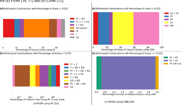

Abstract:Data-driven susceptibility mapping of natural hazards has harnessed the advances in classification methods used on heterogeneous sources represented as raster images. Susceptibility mapping is an important step towards risk assessment for any natural hazard. Increasingly, multiple hazards co-occur spatially, temporally, or both, which calls for an in-depth study on multi-hazard susceptibility mapping. In recent years, single-hazard susceptibility mapping algorithms have become well-established and have been extended to multi-hazard susceptibility mapping. Deep learning is also emerging as a promising method for single-hazard susceptibility mapping. Here, we discuss the evolution of methods for a single hazard, their extensions to multi-hazard maps as a late fusion of decisions, and the use of deep learning methods in susceptibility mapping. We finally propose a vision for adapting data fusion strategies in multimodal deep learning to multi-hazard susceptibility mapping. From the background study of susceptibility methods, we demonstrate that deep learning models are promising, untapped methods for multi-hazard susceptibility mapping. Data fusion strategies provide a larger space of deep learning models applicable to multi-hazard susceptibility mapping.
CCESAR: Coastline Classification-Extraction From SAR Images Using CNN-U-Net Combination
Jan 21, 2025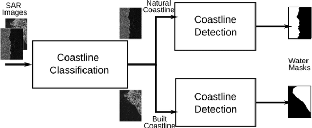
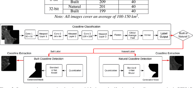
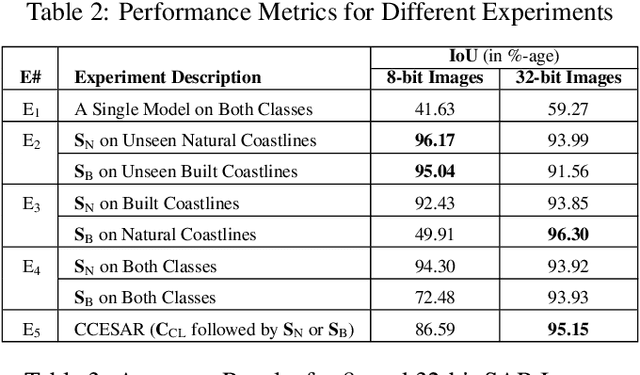
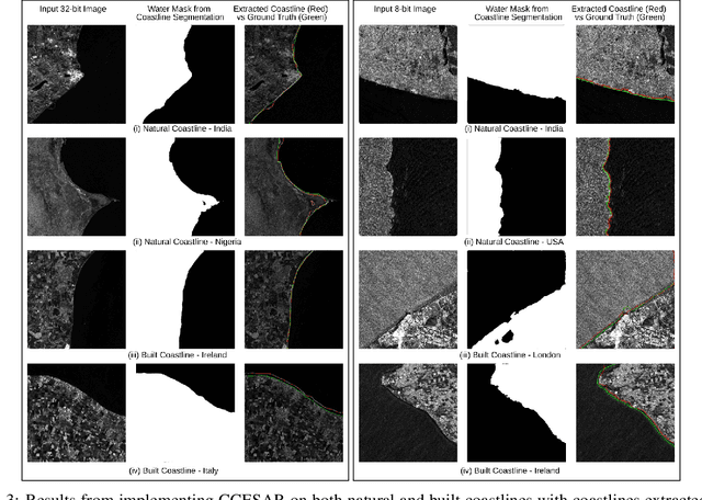
Abstract:In this article, we improve the deep learning solution for coastline extraction from Synthetic Aperture Radar (SAR) images by proposing a two-stage model involving image classification followed by segmentation. We hypothesize that a single segmentation model usually used for coastline detection is insufficient to characterize different coastline types. We demonstrate that the need for a two-stage workflow prevails through different compression levels of these images. Our results from experiments using a combination of CNN and U-Net models on Sentinel-1 images show that the two-stage workflow, coastline classification-extraction from SAR images (CCESAR) outperforms a single U-Net segmentation model.
 Add to Chrome
 Add to Firefox
 Add to Edge